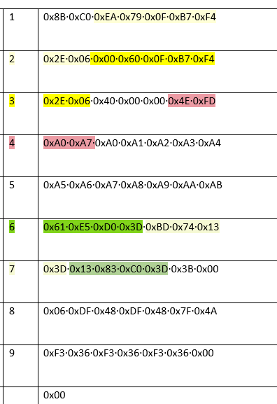
Hello. I’m trying to read a message 1063 from a neo-3x compass using stm32. I’ve almost succeeded. I got timestamps, fix, and longitude. But I can’t figure out the latitude and both heights. In the description on the site, they take up 37, 37, 27, and 27 bits respectively. I tried any combination of bytes marked 0xA0…0xAB in lines 4 and 5, but I have no match with the real coordinate. Please help me determine the latitude and heights! Where and how are these coordinates and heights located in these bytes?
The Neo 3x seems to be communicating via DroneCAN, not Cyphal.
You might want to head over to https://dronecan.org/ for DroneCAN-related topics.
I was there. There is nothing there that could tell how the coordinates and height are located in these 16 bytes (int37 lon, int37 lat, int27 height-ellipsoid, int27height-msl). There is also no support link, only discord. I wrote there, but there is silence.
A strange situation in general. This software is positioned as open source, but in fact it has very poor documentation and no support from developers.
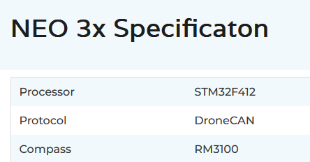
What you are looking for is specified here:
Thank’s!